Yonkers weatherWhat’s on in Yonkers →Events →
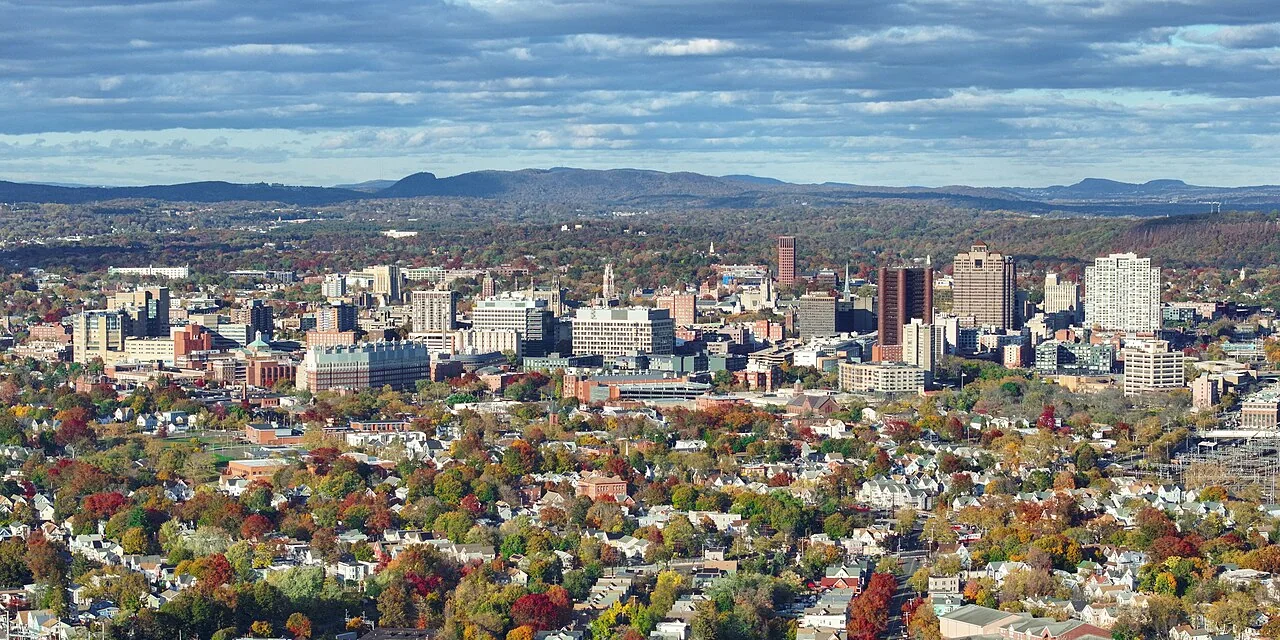
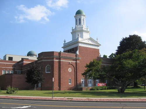
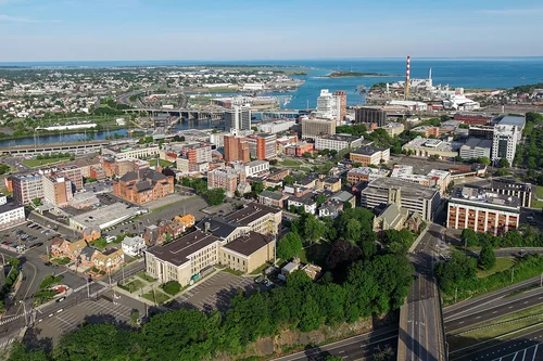
New Haven

Get out of town

Day trips from Yonkers

20 nearby parks, towns and places to explore, ordered by straight-line distance.

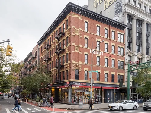
Tenement MuseumNational park site

Tenement Museum

15 miles south · straight-line distance

Museum in Manhattan, New York City.

Confirm the visitor entrance, hours, reservations, access and seasonal conditions. Islands or water destinations may require different transport.

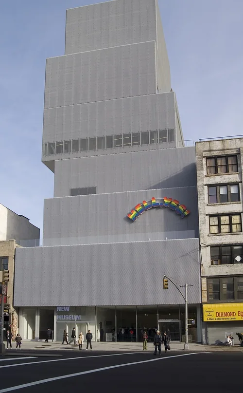
New MuseumThings to do

New Museum

15 miles south · straight-line distanceAbout 30 min by car (18 road miles, typical traffic, checked October 2026)

Contemporary art museum in New York City.

Confirm the visitor entrance, hours, reservations, access and seasonal conditions. Islands or water destinations may require different transport.

National park site

African Burial Ground National Monument

16 miles south · straight-line distance

National monument in New York City.

HistoryAgency site ↗

Confirm the visitor entrance, hours, reservations, access and seasonal conditions. Islands or water destinations may require different transport.

National September 11 Memorial & MuseumThings to do

National September 11 Memorial & Museum

16 miles south · straight-line distanceAbout 30 min by car (18 road miles, typical traffic, checked October 2026)

Memorial & museum in New York City commemorating the September 11, 2001 attacks.

Confirm the visitor entrance, hours, reservations, access and seasonal conditions. Islands or water destinations may require different transport.

Federal HallNational park site

Federal Hall

17 miles south · straight-line distance

Building and historic site in New York City.

Confirm the visitor entrance, hours, reservations, access and seasonal conditions. Islands or water destinations may require different transport.

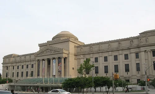
Brooklyn MuseumThings to do

Brooklyn Museum

18 miles south · straight-line distanceAbout 40 min by car (23 road miles, typical traffic, checked October 2026)

Art museum in Brooklyn, New York.

Confirm the visitor entrance, hours, reservations, access and seasonal conditions. Islands or water destinations may require different transport.

National park site

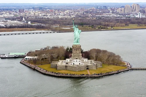
Statue of Liberty National Monument

18 miles southwest · straight-line distance

United States national monument.

BoatingPicnickingAgency site ↗

Confirm the visitor entrance, hours, reservations, access and seasonal conditions. Islands or water destinations may require different transport.

State park

Liberty State Park

18 miles southwest · straight-line distance

Park located on Upper New York Bay in Jersey City, New Jersey.

Confirm the visitor entrance, hours, reservations, access and seasonal conditions. Islands or water destinations may require different transport.

Liberty IslandOutdoors

Liberty Island

18 miles southwest · straight-line distance

Island in the Upper New York Bay, United States.

Confirm the visitor entrance, hours, reservations, access and seasonal conditions. Islands or water destinations may require different transport.

Outdoors

Governors Island

18 miles south · straight-line distance

Island in Manhattan, New York, United States.

Confirm the visitor entrance, hours, reservations, access and seasonal conditions. Islands or water destinations may require different transport.

Campgaw Mountain ReservationSki area

Campgaw Mountain Reservation

18 miles northwest · straight-line distanceAbout 50 min by car (35 road miles, typical traffic, checked October 2026)

County park in Bergen County.

Confirm the visitor entrance, hours, reservations, access and seasonal conditions. Islands or water destinations may require different transport.

StamfordTown

Stamford

21 miles northeast · straight-line distanceAbout 35 min by car (29 road miles, typical traffic, checked October 2026)

City in Fairfield County, Connecticut, United States.

Confirm the visitor entrance, hours, reservations, access and seasonal conditions. Islands or water destinations may require different transport.

ElizabethTown

Elizabeth

25 miles southwest · straight-line distanceAbout 40 min by car (33 road miles, typical traffic, checked October 2026)

City in and county seat of Union County, New Jersey, United States.

Confirm the visitor entrance, hours, reservations, access and seasonal conditions. Islands or water destinations may require different transport.

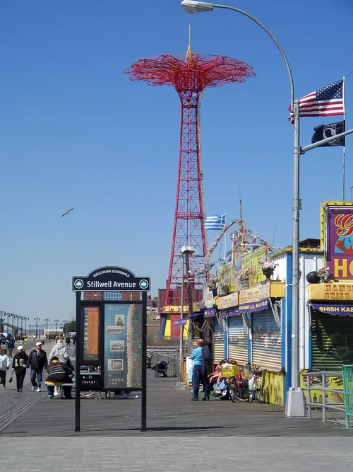
Coney IslandOutdoors

Coney Island

25 miles south · straight-line distance

Coastal neighborhood in Brooklyn, New York City, New York, USA.

Confirm the visitor entrance, hours, reservations, access and seasonal conditions. Islands or water destinations may require different transport.

NorwalkTown

Norwalk

27 miles northeast · straight-line distanceAbout 40 min by car (34 road miles, typical traffic, checked October 2026)

City in Fairfield County, Connecticut, United States.

Confirm the visitor entrance, hours, reservations, access and seasonal conditions. Islands or water destinations may require different transport.

State park

Bear Mountain State Park

27 miles north · straight-line distance

State park of New York state, United States.

Confirm the visitor entrance, hours, reservations, access and seasonal conditions. Islands or water destinations may require different transport.

Outdoors

Long Island

36 miles east · straight-line distance

Island in New York, United States of America.

Confirm the visitor entrance, hours, reservations, access and seasonal conditions. Islands or water destinations may require different transport.

BridgeportTown

Bridgeport

40 miles northeast · straight-line distanceAbout 55 min by car (49 road miles, typical traffic, checked October 2026)

County seat city of Fairfield County, Connecticut, United States.

Confirm the visitor entrance, hours, reservations, access and seasonal conditions. Islands or water destinations may require different transport.

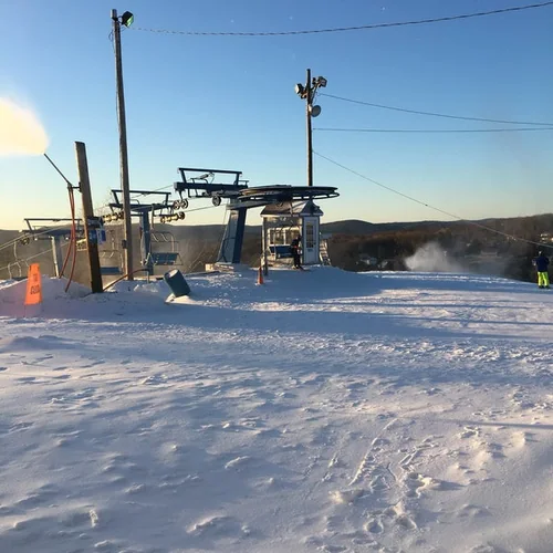
Thunder Ridge Ski AreaSki area

Thunder Ridge Ski Area

43 miles north · straight-line distanceAbout 1 hr 30 min by car (52 road miles, typical traffic, checked October 2026)

Ski area in New York, United States.

Confirm the visitor entrance, hours, reservations, access and seasonal conditions. Islands or water destinations may require different transport.

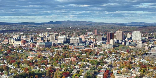
New HavenTown

New Haven

57 miles northeast · straight-line distanceAbout 1 hr 15 min by car (67 road miles, typical traffic, checked October 2026)

City in Connecticut, United States.

Confirm the visitor entrance, hours, reservations, access and seasonal conditions. Islands or water destinations may require different transport.

Driving times are typical estimates from the city center without live traffic, Powered by Geoapify · © OpenStreetMap contributors.

Distances are straight-line measurements from the city, not driving distance. Saved road estimates have no consistently recorded source date and are not current traffic; estimates to park centers, water locations or inconsistent routes are omitted. Named-destination route links are not verified entrances. Place descriptions come from Wikidata; photo credits below include recorded capture dates when available. A photograph does not show current conditions.

Outdoor places near Yonkers

35 recreation areas and campgrounds within 132 miles, from Recreation.gov. Filter by what you want to do.

Recreation area

Hamilton Grange National Memorial

8 miles south · straight-line distanceNational Park Service

Merchant’s clerk, Revolutionary War soldier, first Secretary Treasury of the United States: Alexander Hamilton’s life is memorialized at The Grange, the home he built on a country estate in uptown Manhattan.

History

Recreation area

Paterson Great Falls National Historical Park

15 miles west · straight-line distanceNational Park Service

Silk cloth and steam locomotives; textiles and continuous paper rolls; firearms and aircraft engines. What do these things have in common? All were manufactured in the same place - Paterson, NJ.

History

Recreation area

African Burial Ground National Monument

16 miles south · straight-line distanceNational Park Service

The African Burial Ground stands as the oldest and largest known excavated burial site in North America for both free and enslaved Africans.

History

Recreation area

Castle Clinton National Monument

17 miles south · straight-line distanceNational Park Service

Located at the southern tip of Manhattan, Castle Clinton marks the place where New York City began and reflects the growth of both the city and the nation.

History

Recreation area

Federal Hall National Memorial

17 miles south · straight-line distanceNational Park Service

Here at Federal Hall, George Washington took the oath of office as the first President of the United States, marking the beginning of the American constitutional republic.

History

Recreation area

Ellis Island Part of Statue of Liberty National Monument

18 miles southwest · straight-line distanceNational Park Service

Millions of Americans and people around the world have ancestors who came through Ellis Island. The Main Immigration Building was the epicenter of one of the greatest migrations in modern history.

Picnicking

Recreation area

Governors Island National Monument

18 miles south · straight-line distanceNational Park Service

From 1794 to 1966, the U.S. Army presence on Governors Island played a vital role in the social, political, and economic life of New York City. The island then served as the headquarters of the U.S.

BikingPicnicking

Recreation area

Statue Of Liberty National Monument

18 miles southwest · straight-line distanceNational Park Service

A gift of friendship from the people of France to the United States "Liberty Enlightening the World" is recognized as a universal symbol of freedom and democracy. It was dedicated by President Grover Cleveland on October 28, 1886.

BoatingPicnicking

Recreation area

Lincoln Park Coast Cultural District

20 miles southwest · straight-line distanceSmithsonian Institution Affiliations Program

The Lincoln Park/Coast Cultural District (LPCCD) is one of Newark?s newest organizations, blending arts, cultural planning and event programming with community economic development.

Ranger programs

Recreation area

National Parks of New York Harbor

20 miles south · straight-line distanceNational Park Service

These 12 sites preserve more than 400 years of American history! We invite you to explore the past and investigate its relevance in our lives today.

BikingBoatingCampingFishingHikingHistoryPaddlingPicnicking

Recreation area

Congressman Lester Wolff Oyster Bay National Wildlife Refuge

21 miles east · straight-line distanceFish and Wildlife Service

The Congressman Lester Wolff Oyster Bay National Wildlife Refuge was donated to the Service by the Town of Oyster Bay in 1968 as a habitat for migratory birds, particularly wintering waterfowl.

BirdingBoatingEducational ProgramsFishingNon-Motorized BoatingPhotographyRanger programsWildlife viewing

Recreation area

Sagamore Hill National Historic Site

21 miles east · straight-line distanceNational Park Service

Sagamore Hill was the home of Theodore Roosevelt, 26th President of the United States, from 1885 until his death in 1919. During Roosevelt's time in office, his "Summer White House" was the focus of international attention.

BikingHikingHistoryPicnickingWildlife viewing

Campground

Camp Gateway- Brooklyn Ny

23 miles south · straight-line distanceAbout 55 min by car (37 road miles, checked October 2026)National Park Service

There's no other campground in the world where a family can sleep under the stars, tour the Statue of Liberty, watch a Broadway musical and kayak in one of the world's premier bird migration sanctuaries-all in one trip.

ArcheryBikingCampingFishingHikingHorseback ridingRanger programsStar Gazing

Campground

Camp Gateway - Staten Island

24 miles south · straight-line distanceAbout 45 min by car (29 road miles, checked October 2026)National Park Service

This campground boasts a spectacular view of the Verrazzano-Narrows Bridge, the longest vehicle suspension span in the United States. When it opened in 1964, it was the longest span in the world for 17 years.

BikingBirdingBoatingCampingEvening ProgramsFishingGuided Interpretive WalksHiking

Recreation area

Target Rock National Wildlife Refuge

24 miles east · straight-line distanceFish and Wildlife Service

Target Rock National Wildlife Refuge was acquired in 1967 as a donation from the Eberstadt family, who maintained the land as a garden estate.

BeachBirdingFishingHikingRanger programsWildlife viewing

Recreation area

Gateway National Recreation Area

25 miles south · straight-line distanceNational Park Service

Spanning 27,000 acres from Sandy Hook in New Jersey to Breezy Point in New York City, the park is both the gateway from the ocean into New York Harbor, and the gateway to the National Park Service for millions of visitors every year.

BikingBoatingCampingFishingPaddlingSwimming

Recreation area

Weir Farm National Historical Park

32 miles northeast · straight-line distanceNational Park Service

Visit the home and studio of America's most beloved Impressionist, J. Alden Weir, and walk in the footsteps of generations of world-class artists.

HikingHistoryWildlife viewing

Campground

Camp Gateway - Sandy Hook

34 miles south · straight-line distanceAbout 1 hr 25 min by car (70 road miles, checked October 2026)National Park Service

Welcome to Gateway National Recreation Area, Sandy Hook Unit! There are a variety of cultural and recreational opportunities available at the park including history tours, living history demonstrations, hiking, birding, kayaking, camping,…

BikingBirdingBoatingCampingCanoeingCultural ActivitiesEvening ProgramsFishing

Recreation area

Great Swamp National Wildlife Refuge

36 miles southwest · straight-line distanceFish and Wildlife Service

The Great Swamp National Wildlife Refuge (NWR) is one of more than 560 refuges in the National Wildlife Refuge System that is administered by the Department of the Interior's U.S. Fish and Wildlife Service.

BirdingHikingHuntingNature educationPhotographyRanger programs

Recreation area

Seatuck National Wildlife Refuge

39 miles southeast · straight-line distanceFish and Wildlife Service

The refuge, located in Islip on the south shore of Long Island, consists of 209 acres bordering the Great South Bay, and is separated from the Atlantic Ocean by Fire Island.

FishingHunting

Recreation area

Wallkill River National Wildlife Refuge

39 miles northwest · straight-line distanceFish and Wildlife Service

Wallkill River National Wildlife Refuge manages over 6,000 acres in Sussex County, New Jersey and Orange County, New York. We strive to manage quality habitat for wildlife while providing outdoor recreation for the public.

BoatingEducational ProgramsFishingHuntingPhotographyWildlife viewing

Recreation area

Fire Island National Seashore

50 miles east · straight-line distanceNational Park Service

Immerse yourself in an enchanting collage of coastal life and history. Rhythmic waves, high dunes, ancient maritime forests, historic landmarks and glimpses of wildlife, Fire Island has been a special place for diverse plants, animals and…

BoatingCampingFishingHikingHistoryHuntingSwimmingWildlife viewing

Recreation area

Shawangunk Grasslands National Wildlife Refuge

51 miles north · straight-line distanceFish and Wildlife Service

Shawangunk Grasslands National Wildlife Refuge, which protects 597 acres in Ulster County, NY, was established in July 1999 to support grassland-dependent migratory birds and wintering raptors.

FishingHuntingPhotographyWildlife viewing

Recreation area

Wertheim National Wildlife Refuge

54 miles east · straight-line distanceFish and Wildlife Service

Established in 1947, Wertheim National Wildlife Refuge protects 2,550 acres on the south shore of Long Island.

BirdingBoatingCross Country SkiingEducational ProgramsFishingHikingHistoryHunting

Recreation area

Delaware Water Gap National Recreation Area

56 miles west · straight-line distanceNational Park Service

Situated within the most densely populated region of the United States, Delaware Water Gap National Recreation Area provides a unique opportunity to experience tranquil landscapes, rich human history, and striking scenery along 40 miles of…

BikingBoatingClimbingFishingHikingHistoryHorseback ridingHunting

Recreation area

Hunt Hill Farm

56 miles northeast · straight-line distanceSmithsonian Institution Affiliations Program

The Henderson Americana Center for Culture & the Creative Arts is located on Hunt Hill Farm in New Milford, Connecticut.

Ranger programs

Campground

Alosa Campsites

57 miles west · straight-line distanceAbout 2 hr 5 min by car (102 road miles, checked October 2026)National Park Service

The Alosa Campsites are boat-in only sites located on the west (Pennsylvanian) shore of the Delaware River near Bushkill, Pennsylvania. The side of the river with the campsites will be on your right while traveling downstream.

BoatingCampingCanoeingFishingHikingSwimming

Recreation area

Eleanor Roosevelt National Historic Site

57 miles north · straight-line distanceNational Park Service

Visit the home of Eleanor Roosevelt. Here, Franklin and Eleanor entertained friends, the press, activists, and official state visitors in the relaxed atmosphere of Val-Kill.

Hiking

Campground

Hop Brook Lake Recreation Area

59 miles northeast · straight-line distanceAbout 1 hr 20 min by car (78 road miles, checked October 2026)US Army Corps of Engineers

Hop Brook Lake Recreation Area is located within the towns of Middlebury, Naugatuck and Waterbury, Connecticut. Its 536 acres provide excellent recreation opportunities and a chance to escape from the growing suburbia surrounding the park.

BikingBoatingCampingCanoeingCross Country SkiingFishingHikingKayaking

Campground

Northfield Brook Lake Group Shelters

67 miles northeast · straight-line distanceAbout 1 hr 35 min by car (89 road miles, checked October 2026)US Army Corps of Engineers

Northfield Brook Lake Group Shelters are located along a small scenic lake in the Naugatuck Valley of west-central Connecticut.

BikingBirdingCampingCanoeingFishingHikingHistoryKayaking

Campground

Indian Hollow

112 miles northeast · straight-line distanceUS Army Corps of Engineers

With abundant wildlife, lush scenery and waterfront views, Indian Hollow Group Campground, located at the Knightville Dam and Reservoir, offers groups and clubs a recreational oasis.

BirdingCampingFishingHikingHorseback ridingHuntingMountain BikingStar Gazing

Campground

Blue Marsh Lake (Dry Brooks Day Use Area)

118 miles west · straight-line distanceAbout 2 hr 30 min by car (141 road miles, checked October 2026)US Army Corps of Engineers

Located at Blue Marsh Lake northwest of Reading, Pennsylvania, three group picnic shelters are available for reservations within the Dry Brooks Day Use Area.

BikingBoatingCampingHiking

Campground

Westville Recreation Area

123 miles northeast · straight-line distanceAbout 2 hr 30 min by car (141 road miles, checked October 2026)US Army Corps of Engineers

Westville Lake is situated on the Quinebaug River in the towns of Southbridge and Sturbridge, Massachusetts.

BikingBoatingCampingHikingWinter sports

Campground

West Thompson Lake Campground

125 miles northeast · straight-line distanceAbout 2 hr 45 min by car (158 road miles, checked October 2026)US Army Corps of Engineers

West Thompson Lake Campground is located near the wooded shoreline of its namesake lake in northeastern Connecticut. The natural setting surrounding West Thompson Lake can be enjoyed year round.

BoatingCampingDisc GolfFishingHiking

Campground

Buffumville Lake (Group Shelter)

132 miles northeast · straight-line distanceAbout 2 hr 40 min by car (152 road miles, checked October 2026)US Army Corps of Engineers

In 1958 the U.S. Army Corps of Engineers built Buffumville Dam in Charlton, Massachusetts to provide flood risk management for downstream communities.

BirdingBoatingCampingDisc GolfFishingGuided Interpretive WalksHikingHunting

Recreation areas and campgrounds from Recreation.gov's directory, checked October 9, 2026. Listings are not live availability: check Recreation.gov or the managing agency for open dates, fees, reservations and conditions. Directions go to the listed coordinates, which may not be the entrance. Campground driving times: Powered by Geoapify · © OpenStreetMap contributors.

Questions

What day-trip ideas are near Yonkers?

This guide includes Tenement Museum, New Museum, African Burial Ground National Monument, National September 11 Memorial & Museum, Federal Hall. Places are ordered by straight-line distance. Confirm visitor access, opening hours and current travel conditions before choosing a trip.

How far is Tenement Museum from Yonkers?

Approximately 15 miles south in a straight line. This is not current traffic or a route to a verified visitor entrance. Use the named destination and confirm the appropriate entrance or transport.

How far is New Museum from Yonkers?

Approximately 15 miles south in a straight line; driving takes about 30 min over 18 road miles in typical traffic (Geoapify, checked October 2026). This is not current traffic or a route to a verified visitor entrance. Use the named destination and confirm the appropriate entrance or transport.

How far is African Burial Ground National Monument from Yonkers?

Approximately 16 miles south in a straight line. This is not current traffic or a route to a verified visitor entrance. Use the named destination and confirm the appropriate entrance or transport.

Where can I camp near Yonkers?

Recreation.gov lists 11 campgrounds within 132 miles, including Camp Gateway- Brooklyn Ny (23 miles south), Camp Gateway - Staten Island (24 miles south), Camp Gateway - Sandy Hook (34 miles south). Check Recreation.gov for current availability, seasons and reservations.

Local events, things to do, and independent businesses worth knowing.

Yonkers AI

Your Yonkers local guide
Hey there!

I'm Yonkers AI. Ask about neighborhood food, independent shops, gardens or a museum day.

AI recommendations may be inaccurate. Verify hours and prices. Questions are processed by Cloudflare. Privacy